


Emily is expected to bring heavy rain to Florida
Tropical Storm Emily Forms Off Florida Gulf Coast; Warning Issued
By Jon Erdman
Tropical Storm Emily has formed just off Florida’s Gulf Coast and is poised to deliver more soaking rain to parts of Florida through Tuesday.

The National Hurricane Center early Monday morning initiated advisories on Tropical Depression Six. Two hours later, Doppler radar suggested the tiny circulation had developed winds strong enough to merit an upgrade to “Emily”, the fifth named storm of the 2017 Atlantic hurricane season.
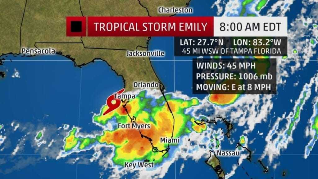
Current Storm Information
The highest cloud tops, corresponding to the most vigorous convection, are shown in the brightest red colors. Clustering, deep convection around the center is a sign of a healthy tropical cyclone.
A tropical storm warning was posted to include the majority of the Tampa/St. Petersburg metro area from Pinellas County southward to Lee County.
A few tropical storm force wind gusts are possible as the center of Emily moves ashore Monday in the warning area.
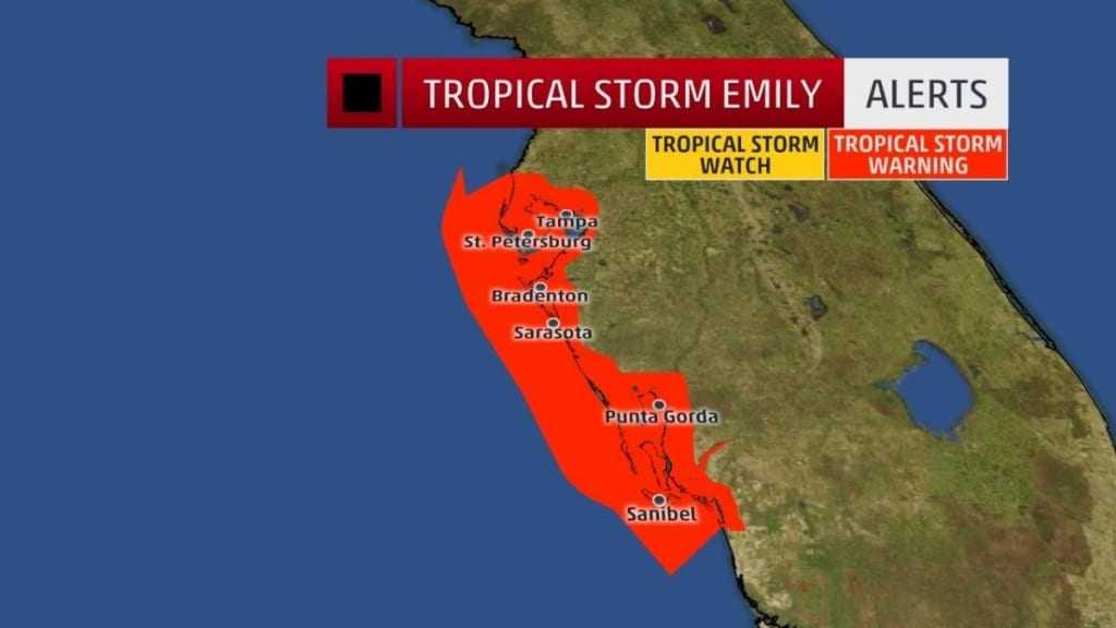
Alerts

A watch is issued when tropical storm or hurricane conditions are possible within 48 hours. A warning is issued when those conditions are expected within 36 hours.
Radar clearly indicated a circulation less than 50 miles west of Pinellas County. Areas of heavy rain had already pushed into parts of central and South Florida, extending to parts of the Atlantic beaches, as well.
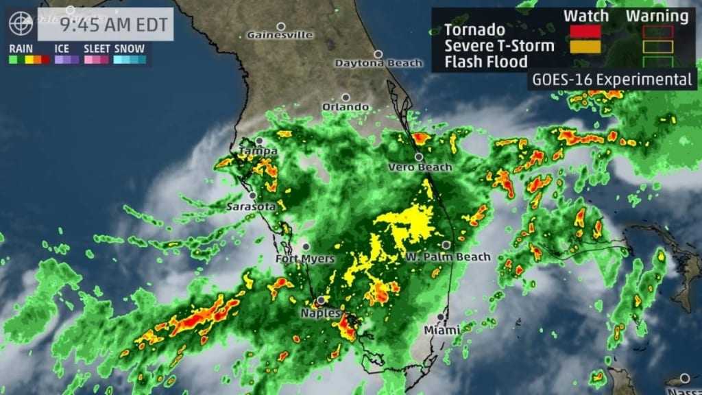
Current Radar, Satellite, Watches and Warnings
Watches and warnings are issued by the National Weather Service.
Forecast: Heavy Rain, Mainly
The threat of heavy rain isn’t a function of how strong a tropical cyclone is, but rather how slowly it moves.
Emily will cross the Florida Peninsula and exit into the Atlantic well north of the northwest Bahamas by early Tuesday.
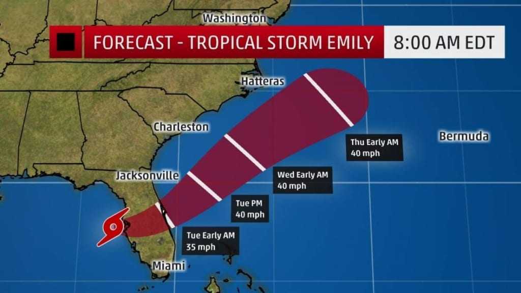
Projected Path
The red-shaded area denotes the potential path of the center of the tropical cyclone. Note that impacts (particularly heavy rain, high surf, coastal flooding) with any tropical cyclone may spread beyond its forecast path.
Areas along and to the south of the track of Emily, a swath across parts of central and South Florida, have the best chance of seeing heavy rain.
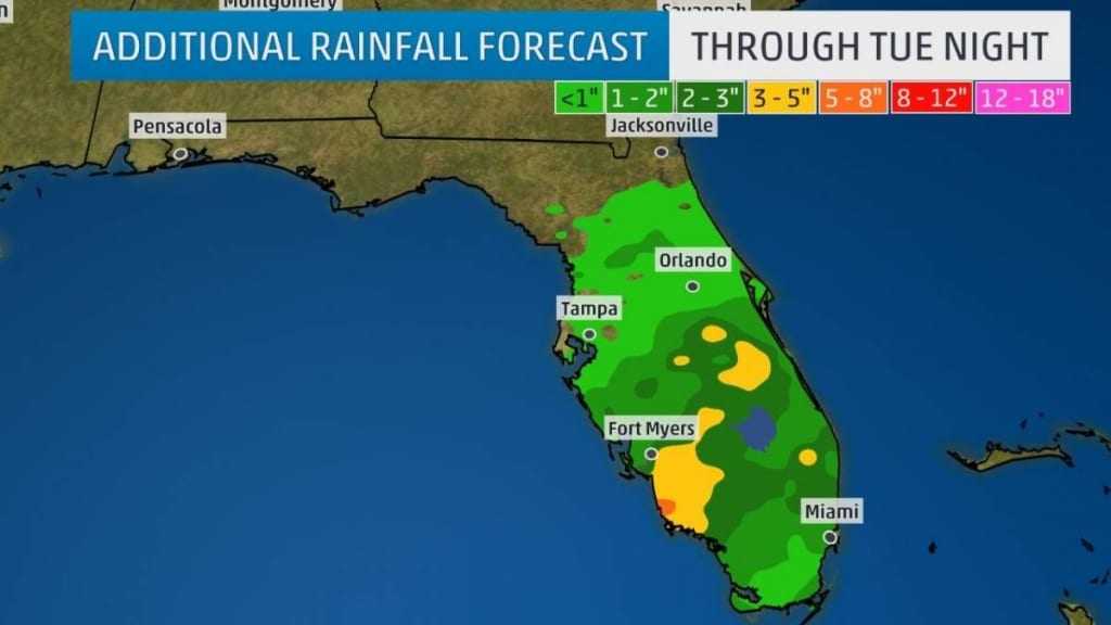
Additional Rainfall Forecast
Locally higher rain totals are possible where heavy rainbands stall for a period of a few hours.
While soil moisture isn’t anomalously high for this time of year, rain rates of 1 to 3 inches per hour are possible in the heaviest rainbands, capable of triggering flash flooding or, at the very least, widespread ponding of water on roads.
This is obviously a more widespread threat of heavy rain than you see on a typical afternoon of scattered thunderstorms in Florida’s wet season.
Little strengthening is expected once the system is over the Atlantic Ocean, and it should remain off the rest of the East Coast and not have any impacts beyond Florida.
This will add to what’s been a rather wet summer in parts of the Sunshine State. According to the Southeast Regional Climate Center, Gainesville and Naples, Florida, have each had their record-wettest summers (since June 1) to date through July 29.

